Listings may include ground-based regional trips. Confirm the aircraft service, actual route and any proposed landing with the named operator.
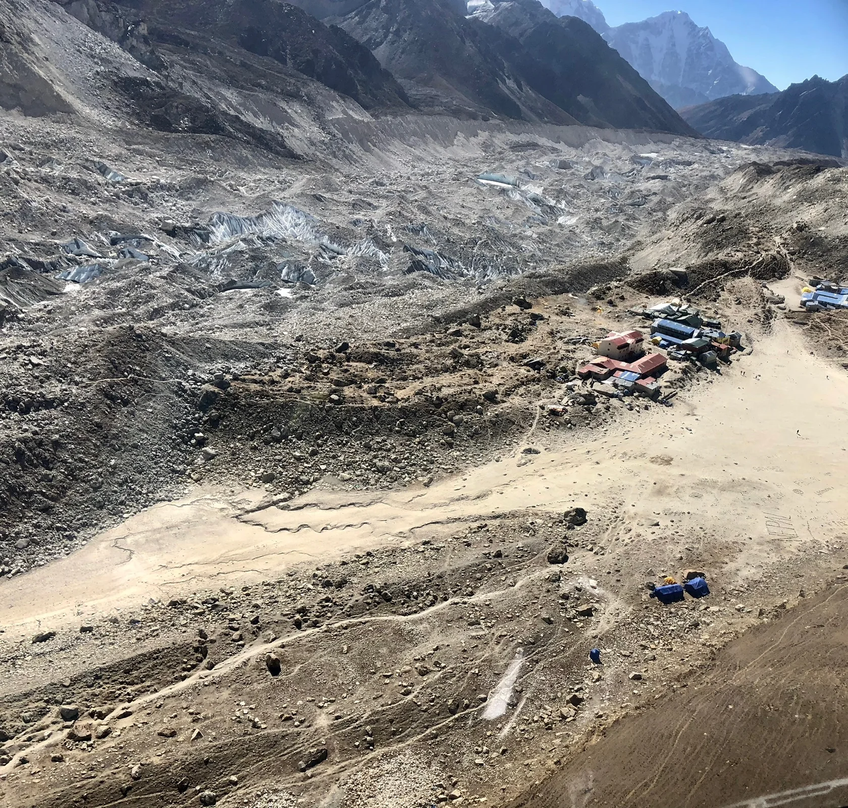
An aerial view changes the relationship between familiar elements. A settlement becomes a small pattern beside a glacier. A valley that feels enclosed from the ground becomes part of a wider arrangement of ridges and tributaries. That change in scale is a reason to look carefully, not a reason to treat every photograph as an itinerary.
Keep the caption with the picture
The leading image shows Gorak Shep and Khumbu glacier moraine from above, photographed in2018. It illustrates a regional setting. It does not identify an aircraft operator, prove permission to land or establish that a current commercial product follows the same route.

Landing Everest Base Camp Kalapathar by Helicopter with Breakfast
Helicopter tour to Everest base camp:- Landing at Mt. Everest base camp, Kalapather with the best view of Mt Everest & other Himalayas, It is a landin...

Kathmandu Sightseeing | UNESCO World Heritage sites Private/Group
Embark on a captivating journey through Kathmandu with our Private Kathmandu Sightseeing Tour. Led by our expert Eng...

Kathmandu: Full Day 7 UNESCO Tour with Lunch - Private/Group
The Seven World Heritage Day Tour of Kathmandu presents a distinctive convergence of history, culture, and spiritual...

Kathmandu Food and Drink Walking Tour
Namaste! Come hungry to explore Kathmandu's culinary wonders on an immersive walking tour led by a professional lice...
UNESCO’s Sagarmatha National Park description places mountains, glaciers and inhabited landscapes in a wider heritage context. The scenery is not an empty stage. Keeping settlements and their surroundings in the story helps avoid reducing the region to a single summit image.
Notice three relationships
- Surface and scale: look at the texture of ice and debris alongside the size of buildings.
- Valley and ridge: notice how the line of the land changes with the camera’s angle.
- Settlement and route: distinguish a place visible in the image from somewhere a visitor actually enters.
These are ways of reading a photograph, not navigation instructions. A ridge can hide terrain behind it, and a distant peak may be difficult to identify without a reliable caption. Do not assign a place name simply because a shape resembles a familiar picture.
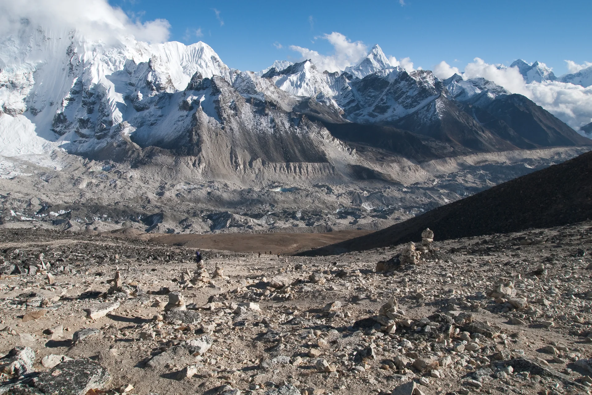
Compare with a ground view
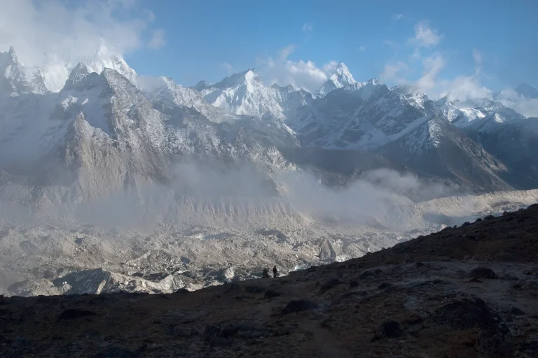
The accompanying Khumbu Glacier photograph was taken from Kala Patthar in2009. Its viewpoint is on the ground. Set beside an aerial image, it shows why the same region can appear very different without either photograph being misleading. The distance, angle, lens and visible weather all influence what fits inside the frame.
Questions for an image-led listing
- Does the caption identify the place and viewpoint?
- Is the image an illustration of the destination or part of the actual service?
- Which elements are included in the itinerary, and which are simply visible scenery?
- What conditions or operational decisions can change the view?
Keep cloud, haze and seasonal differences visible in your expectations. An image selected for clarity cannot guarantee the same visibility on another day. If you are choosing a flight because of a particular view, ask the operator how the proposed route relates to it.

Private Bhaktapur and Nagarkot Day Tour From Kathmandu
The day trip to Bhaktapur and Nagarkot from Kathmandu takes you to the ancient city of Bhaktapur and the most popular Himalayan viewpoint closer to Ka...

UNESCO Seven World Heritage Tour in Kathmandu
There are seven awe-inspiring UNESCO World Heritage Sites in the Kathmandu Valley. Dating back over 2000 years, the...

Kathmandu: Full Day Top 4 UNESCO Tour with Lunch - Private/Group
A Kathmandu sightseeing tour is a captivating journey through Nepal's rich cultural and spiritual heritage. Start yo...

ZipFlyer Nepal - The World's Steepest Zip-line
Welcome to the most stunning Zipline on the planet. Zipflyer Nepal is a 1.8km Zipline located in Pokhara Nepal with...
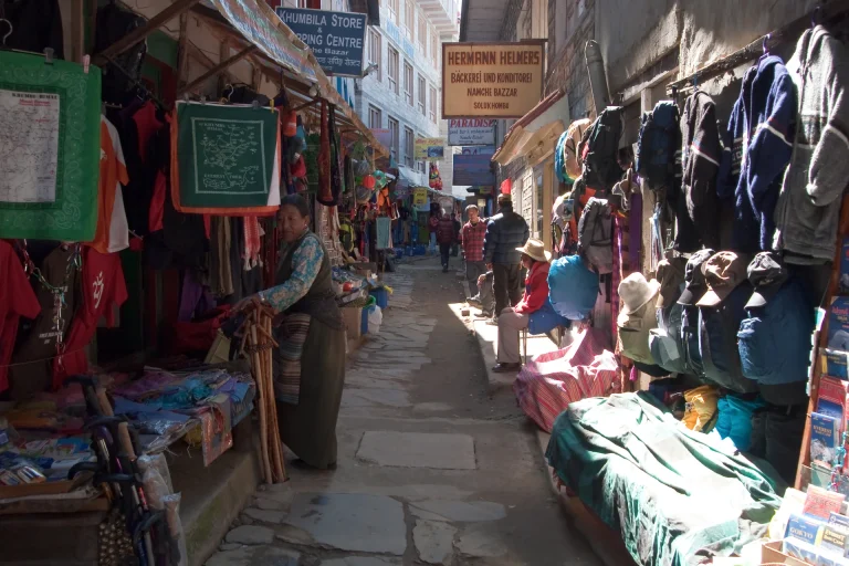
Continue with Namche’s ground-level context or return to the itinerary comparison. The purpose is to understand what a photograph communicates before asking it to support a booking decision.